AI Live Sim

By clicking Subscribe you're confirming that you agree with our Terms and Conditions.
Beyond the Scenario: Sensor Fusion, Digital Battlefield Reconstruction, and the Infrastructure for Adaptive Drone Software
Adaptive Software Requires More Than Isolated Test Cases
No Single Sensor Works Across All Battlefield Conditions
Environment Realism Through Scene Reconstruction
Continuous Improvement Through ATP and IST
The Integrated Use Case
The Platform Advantage
Ready to Take the Next Step?
Article
Beyond the Scenario: Sensor Fusion, Digital Battlefield Reconstruction, and the Infrastructure for Adaptive Drone Software

April 8, 2026 • 8 min read


AILiveSim Defense Drone Series | Article 3 of 3
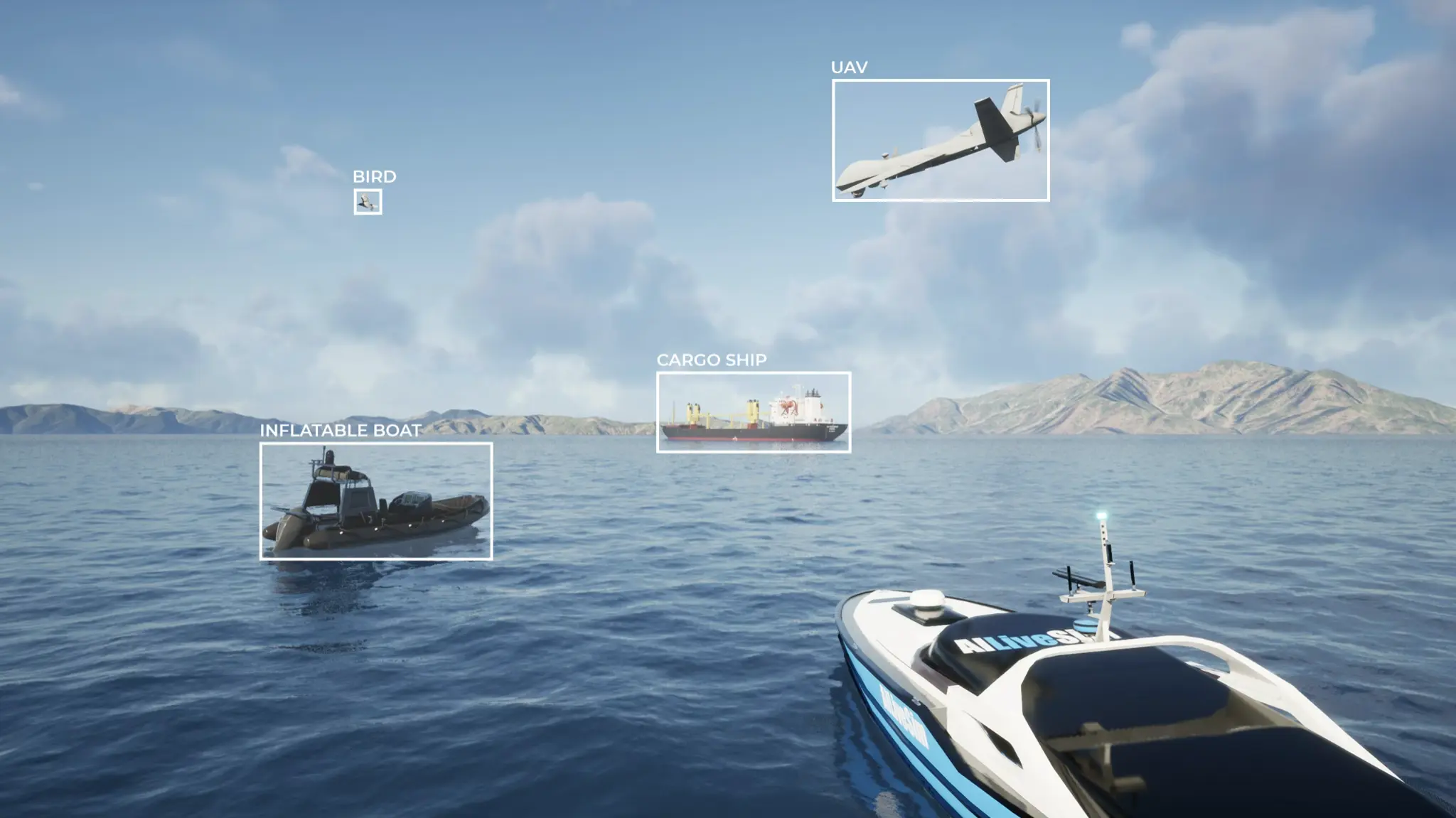
Sensor Fusion and Battlefield Reconstruction with AILiveSim
Adaptive Software Requires More Than Isolated Test Cases
Modern drones do not fail only because of one bad model decision. Failures can stem from perception errors, missing training data, or gaps in how the validation environment represents reality. A patchwork of disconnected tools, one for sensor simulation and another for scenario generation with no shared pipeline between them, leaves integration gaps that mirror the gaps in the drone's own software. The development environment needs to be as integrated as the system it is building.
No Single Sensor Works Across All Battlefield Conditions
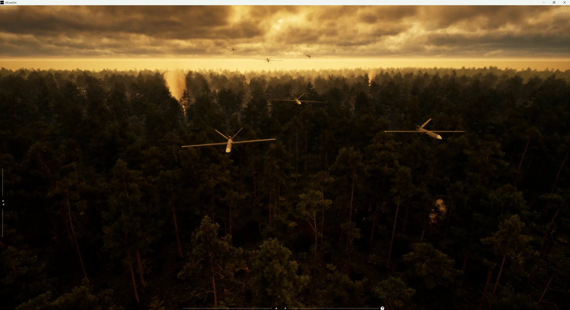
Cameras degrade in darkness or glare. LiDAR picks up what cameras lose in fog, while radar covers ranges where optical sensors cannot resolve targets. Infrared is the one that fills the gap in nighttime and low-visibility operations. A drone relying on any single sensor will fail in conditions that degrade that sensor's performance. Real robustness means training systems to fuse these signals from the start, treating integration as a day-one requirement. Check out our multi-sensors here.
AILiveSim simulates all sensor types simultaneously in the same clock time, enabling true fusion training rather than disconnected sensor-specific workflows. Each sensor is modeled with appropriate fidelity, including noise, defects, and environmental interference. Engineers can compare sensor-stack configurations against specific conditions and obstacle types inside the simulator, informing hardware decisions before physical prototypes are built. The helicopter OEM case demonstrated this: anti-collision performance was validated across weather, terrain, and obstacle configurations using synchronized multi-sensor simulation.
Environment Realism Through Scene Reconstruction
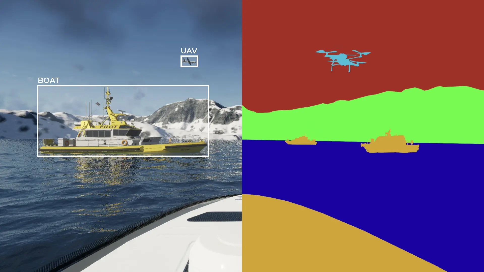
Multi-sensor fusion in simulation
A defense drone does not operate in abstract terrain. It operates in specific, changing places. In contested environments, the landscape shifts constantly. A drone being prepared for a specific theater needs training data that reflects what that location looks like today, not what a generic terrain map suggested two years ago.
AILiveSim integrates satellite and imagery-based scene reconstruction. The latest satellite imagery, ground-level photos, or intelligence feeds are processed into a simulation-ready environment in a few clicks. When new intelligence arrives or terrain conditions change, software updates can be validated in the reconstructed environment before being pushed to the fleet. This keeps simulation grounded in the operational reality of a specific deployment, not a static reference model.
Continuous Improvement Through ATP and IST
The Automated Training Pipeline (ATP) analyzes operational data, identifies coverage gaps, and generates targeted synthetic data to fill them. It does not just produce more data. It produces the right data, focused on the specific conditions where the model is weakest.
When validation is the priority, the Intelligent System Testing (IST) module searches for failure modes across high-dimensional parameter spaces, acting as an automated red team. Together, these support both retraining and validation as one development cycle rather than separate workflows. For defense programs, this compresses the loop from field observation to validated software update from months to days. See our technical brief on IST here.
The Integrated Use Case
New mission data reveals degraded tracking performance in a mountainous border zone under mixed weather. The terrain is reconstructed from the latest satellite imagery. The sensor stack is re-evaluated in simulation against the specific environmental conditions. Synthetic variations are generated to cover the identified gaps. The model is retrained. IST probes remaining weak points across the expanded scenario set. The updated software is validated and ready for deployment. Each step feeds the next, and the full cycle runs without switching between disconnected tools.
The Platform Advantage
Adaptive drone software depends on an adaptive development environment. Sensor fusion, realistic environments, and automated pipelines all have to work as one system. AILiveSim provides the simulation backbone that lets defense software evolve with the battlefield, giving programs the speed to keep fielded systems current as threats evolve.
Ready to Take the Next Step?
Resources:
- Thermal Camera Sensors & AILiveSim
- Read our White Paper about the sim to real gap: Using Synthetic Data from AILiveSim to Train Robust Maritime Detection Models
- AILiveSim Glossary of Terms
Resources
Explore Our Latest Insights
Stay informed with our expert articles and updates.
Article
Have You Tested Enough? Intelligent System Testing and the Coverage Problem
Test volume measures effort, not proof. How Intelligent System Testing samples scenarios adaptively to map where an autonomous system works, where it fails, and which combination of conditions moves it from one to the other.
AILiveSim
August 22, 2026 • 4 min read
Article
Swarm Defense Testing: Measuring Intercepts, Not Detections
Why no volume of captured data validates swarm defense: adversarial scenarios generated live around the system under test, scored as intercepts achieved versus hits on the protected vessel across repeatable, parameterizable waves.
AILiveSim
August 17, 2026 • 4 min read
Article
Counter-Drone Detection: Why Precision Fails Before Recall Does
Why counter-drone detection fails on precision before recall: negative-class coverage by sensor channel, and scoring threats neutralized alongside friendlies preserved on repeatable, configurable drone waves.
AILiveSim
August 13, 2026 • 4 min read

Article
What Has to Be Inside an Airport Digital Twin Before It Is Worth Anything
What an airport digital twin must contain before it is worth anything: rare surface conditions, four time-aligned sensors, automatic labelling, and procedural generation that extends to your airport.
AILiveSim
August 10, 2026 • 4 min read

Discover the benefits of synthetic data and simulation
By navigating on this site you agree that we use only minimal cookies required for this site to function. We do not monetize your data.